New Online Map Details Hayes Preserve Trails at Civic Center
June 30, 2025
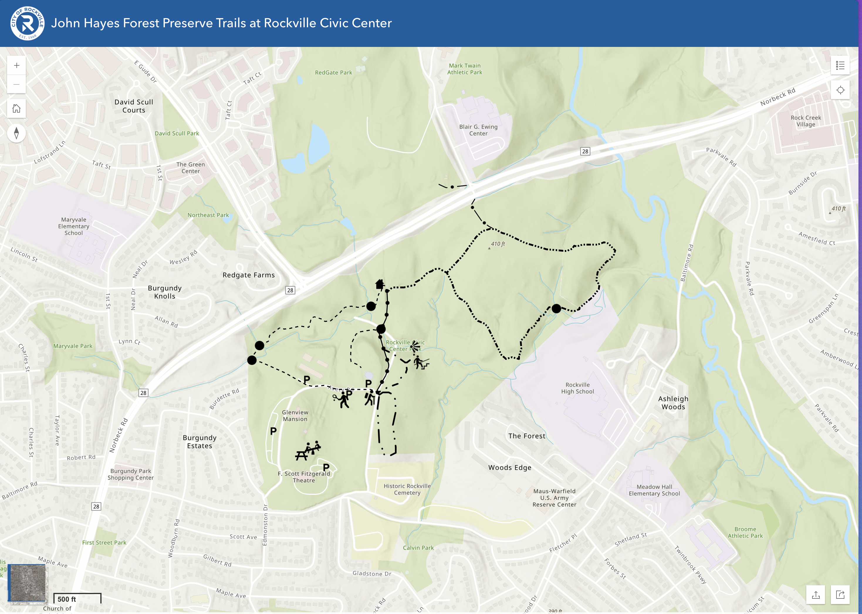
More than 3 miles of trails in the John G. Hayes Forest Preserve, adjacent to Croydon Creek Nature Center, became a little easier to navigate through the addition of map that hikers can access online.

The map shows hikers’ locations in realtime, when opened on a mobile device, to help them determine where they are, even if they take a wrong turn.
Each of the six trails within the preserve have descriptions when clicked on in the map, with information that includes activity level and length, and icons show the location of trailheads, parking, bridges and other details.
The map also lists points of interest and amenities within Rockville Civic Center Park, including parking locations, picnic areas and the trailhead.
The preserve is named in memory of John G. Hayes, former superintendent of Rockville’s parks and facilities. His contributions to the city spanned 30 years and included many special events still enjoyed today.
Find the map at bit.ly/hayestrails. Learn more about Croydon Creek Nature Center at rockvillemd.gov/croydoncreek.